How To Use A Handheld GPS For Fishing

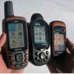
Global positioning system (GPS) applies the satellites located in the space to identify specific locations on the surface of the Earth. A GPS instrument helps people to find different unknown places. The handheld GPS instruments have made this task easier. The fishermen can utilize the handheld GPS for fishing; for instance, to mark the fishing locations and to return back to the shore. This article focuses on some instructions on how to use a handheld GPS for fishing.
Table of Contents
Load the Essential Maps
At first, turn on your handheld GPS. You need to check the map provider of your handheld GPS receiver. Then, load your required maps into the memory of the GPS receiver. Some handheld GPS offers the Nautical charts in their mapping providers.
Connect to the Computer
The handheld GPS receivers offer different methods for being connected to the computer, depending on their specific models. For instance, the DeLorme model offers a USB option for facilitating the serial connections and transferring data via the Topo USA. The other popular models like the Garmin and the Magellan can be connected through the serial ports. These models transfer data through proprietary software called “Vantage”. In these ways, many other brands are connected to the computers through proprietary cords or USB port or serial connection ports. You are recommended to check the manual provided by the GPS manufacturer company, from which you have your handheld GPS. The manual will help you to understand the process of connecting a specific model of the handheld-GPS receiver to your computer. Disconnect the GPS from the computer and check that the data are in the device’s memory.
Mark the Starting Point
While you are preparing to commence your fishing kayak or starting to set up any fishing site upon the shore, you need to be ensured that the GPS receiver is getting the signal in a stronger way and is showing your current location accurately. If you observe that the signals are weak or not properly accurate, then wait for some moments so that the GPS receiver can acquire a connection to satellites. After that press the specific button on your handheld GPS receiver to mark your current location using the measurements of latitude as well as longitude. The GPS receiver will store this information as a sign, which will help you to return to the shore after you have finish catching fish.
Use the ‘Zoom’ Option
You need to zoom in the display of the handheld GPS receiver to an opposite scale. For boating, you are recommended to zoom ‘in’ the screen in the scale of 1/4th a mile or any other smaller unit. Moreover, if you are fishing from any riverbank or the fly-fishing, then try to zoom ‘in’ at the on-screen scale of 80-160 feet. You need to consider the underwater terrain as well as the extent of the water surface. After starting a journey over the water surface keeps an eye on the records of your handheld GPS receiver to record your positions as well as the travel route.
A piece of ertuodiin unlike any other!